The redistricting of the City Council’s five districts can either help or harm the prospects for diverse representation on the Council.
Like with Congressional, State Senate and State House of Representatives districts, the five districts on the New Britain City Council, commonly called “wards”, are reapportioned every ten years, following the national decennial census. Two thirds of New Britain’s fifteen member Council are elected, two each, from the five wards. Another five Council members are elected at-large.
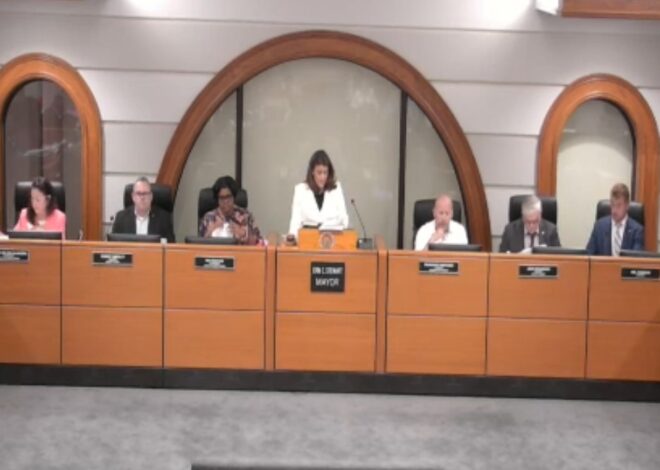
The reapportionment, also called redistricting, is done to ensure that each district represents approximately the same number of people. The city began the Council reapportionment with the appointment of a Redistricting Commission in January by the 12 to 3 Republican majority Council.
The federal census identifies where people live down to minute areas called census “blocks”. New Britain is divided into numerous of these blocks, each with a certain number of people living within them. Creating the new City Council Wards will involve jigsaw-puzzling together these blocks into five districts of similar population.
But what may seem as a mundane process is, in fact, very tumultuous, nationwide. Across the country, lawsuits have already been filed in a number of states alleging racism in the drawing of legislative districts. A number of lawsuits, by both Republicans and Democrats, allege partisan “gerrymandering” — the practice of creating districts to give unfair advantage to one party over the other, regardless of the voters’ votes.
Racist and partisan considerations in districting have intertwined. As the Pew Research Center has said, Black, Latino and other voters of color, “make up four-in-ten Democratic voters but fewer than a fifth of Republican voters. Suppressing the votes and voting power of communities of color has widely been seen as to the partisan advantage of Republicans.
An analysis done by New Britain Progressive volunteer efforts, using the web service, Dave’s Redistricting, shows how the relative voting power of communities of color and white people can be dramatically different, based only on how the ward lines are drawn.
Dave’s Redistricting says that it,
is a team of volunteers with a shared passion for technology and democracy. Our mission is to empower civic organizations and citizen activists to advocate for fair congressional and legislative districts and increased transparency in the redistricting process.
According to data from Dave’s Redistricting, about 57.5% of New Britain’s voting age population are Latino, Black, Asian American or other communities of color, while about 42.5% are white. By the math, it would be expected that people of color would have a decisive majority in about 60% of the Council wards, three of the five — deciding at least 6 of the 10 ward Council seats.
But it is also possible to create a districting plan for the City Council with the opposite effect — a map with three wards with a majority voting age population who are white.
That would appear to be the effect in the first example (Example 1) created using Dave’s Redistricting. The districts shown in red, orange and light blue would appear to each have majority white voting age populations.
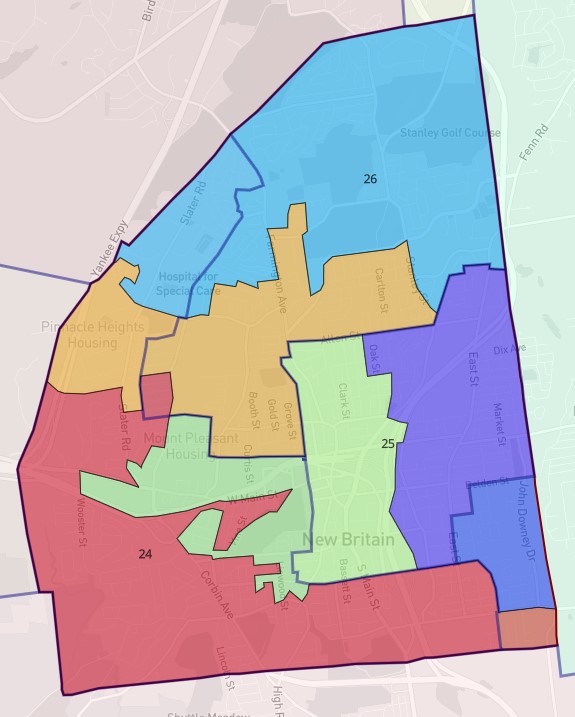
In another example (Example 2) the opposite would be true. In three of the wards in this example, shown in orange, green and dark blue, a majority of the voting age population would appear to be Latino, Black, Asian American or other community of color. The other two would appear to be majority white voting age population.
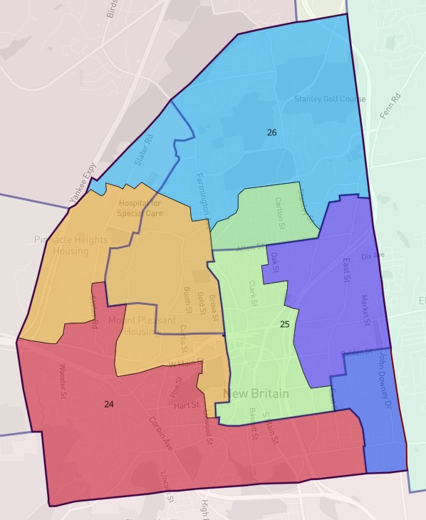
In a third example (Example 3), those same possible wards, shown in orange, green and dark blue, would also appear to have majority Black, Latino, Asian-American and other community of color voting age population. But in the case of this third example, the majorities of communities of color would appear to be larger than in Example 2.
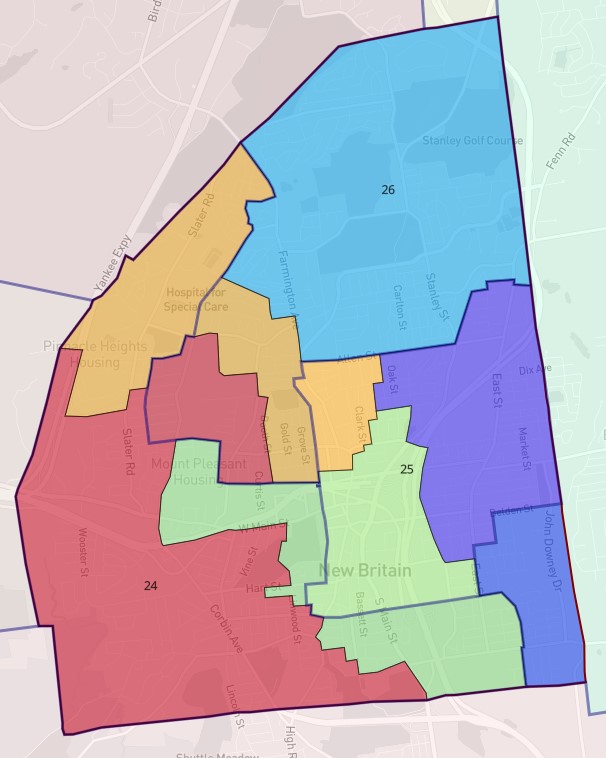
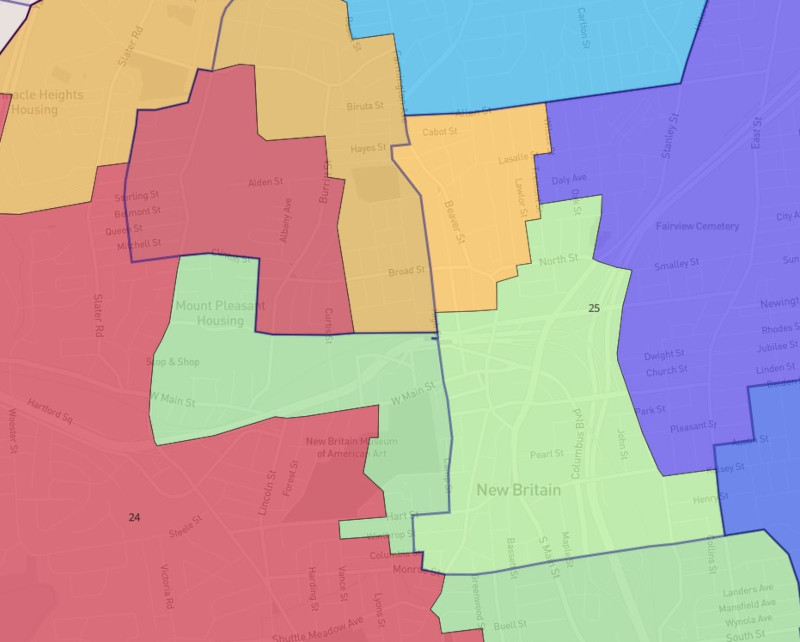
In each of the maps, the dark blue lines are the borders of the new state House of Representatives districts.
The Redistricting Commission is expected to meet on Tuesday, February 15, 2022 at 6:00pm in City Hall.
The Commission’s responsibility is to report a draft map of Council districts for the Council to review and approve. If either the commission or Council miss deadlines provided for in the City Charter, the mayor then proposes a three-person commission, who then make the final decision on the district lines.
The Charter requires that each of the five Council wards,
(1) shall be of substantially equal population and otherwise consistent with all federal and state constitutional and statutory requirements; (2) to the extent possible consistent with the preceding, shall maintain the integrity of recognized neighborhood planning areas; (3) shall be geographically contiguous and compact; and (4) to the extent possible consistent with the preceding, shall be consistent with existing legislative districts.
Once approved, the new City Council ward boundaries will remain in effect for ten years. Those districts will be in place for the 2023, 2025, 2027, 2029 and 2031 city elections.

